Life and Resilience in Kashechewan First Nation
Have you ever wondered what daily life really looks like in the Kashechewan First Nation right now? I was looking at some maps of Northern Ontario recently, and it struck me how similar the harsh, unyielding winter landscapes are to parts of Ukraine where I grew up. Living in a place where nature dictates your every move builds a specific kind of resilience. You don’t fight the weather; you adapt to it. This community, nestled near James Bay along the mighty Albany River, is a perfect example of human endurance and incredibly strong cultural roots.
I always find myself fascinated by communities that maintain their deep ancestral connections despite overwhelming geographical and political odds. For the Cree people living here, the land isn’t just a place to put houses; it is a living, breathing entity that provides food, identity, and history. However, being situated on a low-lying floodplain has brought immense challenges, especially during the spring thaw. The annual threat of flooding forces frequent evacuations, tearing people away from their homes temporarily. But the spirit of the people never wavers. They return, rebuild, and push forward, demanding better infrastructure and a long-term solution. Resilience isn’t just a word here; it is a daily practice. By exploring the realities of this northern community, we can better understand the broader struggles and triumphs of Indigenous populations across Canada.
Read also: Understanding the robinson huron treaty Impact; Harrison Healthcare Care and Benefits Guide.
The Daily Realities and Deep Community Bonds
To truly grasp what it means to live up north, you have to look at the daily logistics. Living in a remote fly-in community for most of the year shapes every aspect of life, from how groceries are delivered to how families stay connected. When the winter ice roads finally open, it’s a massive rush of activity—trucks bringing in heavy supplies, families traveling to visit relatives in other communities, and a general sense of mobility that simply doesn’t exist in the summer months.
Let me show you a quick breakdown of the core geographic and social realities this community navigates every single day:
| Aspect of Life | Geographic Reality | Community Impact |
|---|---|---|
| Transportation | Fly-in only for 8-9 months of the year, winter roads in deep freeze. | High cost of living, but creates a tight-knit reliance on local resources. |
| Spring Season | The Albany River is highly prone to massive ice jams and flooding. | Annual evacuations disrupt schooling and life, forging a collective demand for relocation. |
| Traditional Diet | Surrounded by rich boreal forest and coastal wetlands. | The spring goose hunt remains a vital cultural and nutritional pillar. |
There is immense value in maintaining these traditions. For example, the spring goose hunt isn’t merely a hobby; it is a crucial food source that offsets the astronomical prices of store-bought groceries flown in from the south. Another example is the transfer of the Cree language. Elders passing down linguistic nuances to the youth ensures that the cultural worldview remains intact, even as teenagers scroll on the same smartphones as kids in Toronto.
Here are three defining pillars that make the community so unique:
- The Winter Road Network: This temporary highway built entirely on ice and packed snow is a lifeline. It represents a brief window of heavy commerce and deep social connection with neighboring towns.
- The Niska (Goose) Harvest: A time when the community practically empties out into the bush. It is a period of intense work, celebration, and intergenerational teaching.
- Unyielding Advocacy: The continuous, organized push by community leaders for a safer, higher ground location (Site 5) shows a masterclass in political endurance.
Origins of the Community
The history here runs incredibly deep. Long before borders were drawn or treaties were signed, the Omushkegowuk (Swampy Cree) people navigated the James Bay lowlands. They were nomadic, moving with the seasons to hunt, trap, and fish. The rivers were their highways. When European fur traders arrived, the Albany River became a major artery for the Hudson’s Bay Company. However, the ancestors of the current residents didn’t live in a stationary, year-round settlement. They gathered in the summer and dispersed to family trapping grounds in the winter.
Evolution Through the Decades
Things shifted drastically in the 20th century. With the signing of Treaty 9, the federal government began centralizing Indigenous populations to administer services, schools, and healthcare. Originally, the people of Kashechewan and nearby Fort Albany were considered one band. However, religious differences—primarily between Anglican and Catholic factions—led to a split. In the 1950s, the Anglican group moved upriver to the current site. Unfortunately, the site chosen by the government officials was a highly vulnerable floodplain. They built permanent structures on land the Cree traditionally knew was unsafe for year-round habitation.
Modern State of Affairs
Fast forward to today, and the community is still grappling with the consequences of that mid-century geographic error. Decades of stop-gap measures, like building dikes and sea walls, haven’t solved the core issue. The primary focus right now is the relocation to Site 5, a higher, safer area further up the river. Leaders have signed agreements, but the bureaucratic wheels turn agonizingly slow. The youth are stepping up, using social media to share their stories, demanding clean water, safe housing, and an end to the trauma of yearly evacuations.
The Floodplain Geography
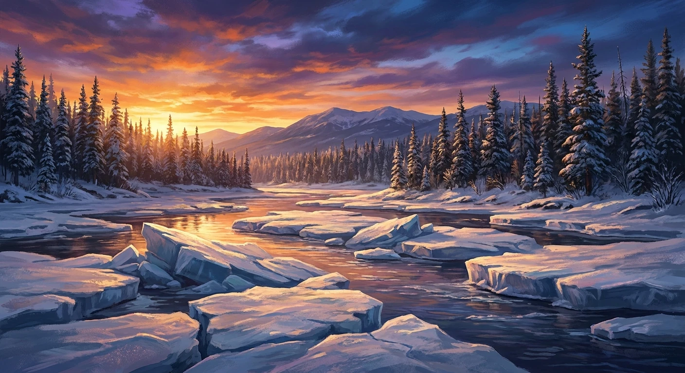
Let’s get a bit technical about why the flooding happens so violently here. The Albany River flows north toward James Bay. In the spring, the southern parts of the river melt much faster than the frozen mouth at the bay. As millions of gallons of water and massive chunks of ice rush northward, they slam into the solid, frozen sections of the river. This creates a terrifying natural dam known as an ice jam. The water has nowhere to go but up and over the banks, rapidly inundating anything built on the low-lying plains. The hydrology of a north-flowing river in a subarctic climate is notoriously unpredictable and violent.
Infrastructure and Climate Impacts
The physical toll on the town’s infrastructure is devastating. You can’t just build a regular basement in this region. The ground underneath is characterized by discontinuous permafrost—layers of soil that remain frozen year-round. When floodwaters saturate the ground, and as global temperatures rise, this permafrost degrades. Now that we are in 2026, the data shows these thaw cycles are becoming even more erratic. The shifting ground warps housing foundations, destroys underground water pipes, and makes long-term construction nearly impossible on the current site.
- Permafrost Thaw: Causes severe structural settling and foundation cracking in over 70% of older local homes.
- Ice Mechanics: Spring ice blocks can weigh several tons, acting like bulldozers against man-made dikes.
- Water Contamination: Floodwaters routinely overwhelm the local sewage lagoon, leading to boil-water advisories and severe health risks.
- Climate Shifts: Warmer, shorter winters mean the vital ice roads are open for fewer weeks, drastically reducing the window for transporting heavy building materials.
7-Day Plan to Understand and Support Northern Communities
If you are reading this and wondering how you can better educate yourself or be a solid ally to remote Indigenous communities, I put together a simple, step-by-step approach. You can literally take this one day at a time over a week to build a comprehensive understanding.
Day 1: Learn the Geography
Start by pulling up a satellite map. Trace the Albany River from inland Ontario all the way to James Bay. Notice the complete lack of permanent road networks. Understanding the absolute physical isolation is the first required step to empathizing with the logistical nightmares the residents face daily.
Day 2: Understand Treaty 9
Spend a few hours reading up on the James Bay Treaty (Treaty 9). This historical document dictates the legal relationship between the federal government and the First Nations of the region. Look up the differences between the written text and the oral promises made to the Indigenous leaders at the time.
Day 3: Study the Evacuation Cycle
Look up news footage of the spring evacuations. Imagine having to pack a single bag, grab your kids, and board a military cargo plane just because the ice broke the wrong way. Understand the psychological toll this takes on children who miss weeks of school every single year.
Day 4: Follow the Relocation Project
Research “Site 5”. This is the proposed higher-ground area where the community desperately wants to move. Track the political promises made by various federal governments over the past two decades regarding funding for this move, and note the delays.
Day 5: Support Indigenous Artists
The culture is vibrant! Seek out Cree artists, musicians, and writers from the James Bay lowlands. Buy their beadwork, listen to their podcasts, and consume the media they produce. Supporting them financially and algorithmically helps keep their voices front and center.
Day 6: Advocate for Clean Water
Clean drinking water is a basic human right, yet many remote reserves still face boil-water advisories. Find out which organizations are actively fighting for water equity in Canada and lend your voice, sign petitions, or donate if you have the means.
Day 7: Share the Knowledge
Take everything you’ve learned and talk about it. Tell a friend over coffee, share a well-researched article on your social feeds, or bring it up in a study group. Awareness breaks down the barriers of isolation. The more people down south know about the north, the harder it is for politicians to ignore the issues.
Myths and Reality
There are always misconceptions when people from urban areas look at remote communities. Let’s clear some of them up right now.
Myth: The people should just pack up and move to cities in the south if it floods so much.
Reality: This land is their ancestral home. Asking an entire culture to abandon their hunting grounds, language hubs, and deep spiritual connection to the land is a massive oversimplification and deeply colonial. They don’t want to leave the region; they just want to move upriver to safe ground.
Myth: Building a new town is a fast and easy process.
Reality: Relocating a town in a fly-in zone is a logistical mountain. You have to build roads, lay water pipes in permafrost, construct schools, and move heavy machinery entirely during the short winter road season. It takes years of meticulous planning.
Myth: Indigenous youth in remote areas are disconnected from their culture.
Reality: Quite the opposite. There is a massive resurgence happening. Youth are aggressively reclaiming the Cree language, participating in traditional hunts, and blending ancient traditions with modern digital storytelling.
Frequently Asked Questions
Where exactly is the community located?
It is located in Northern Ontario, Canada, on the northern shore of the Albany River, just a few kilometers inland from the James Bay coast.
What language do the residents speak?
The primary languages spoken are Swampy Cree and English. Cree is widely used in daily life, hunting, and local broadcasting.
Why does the river flood so badly?
Because the Albany River flows north, the southern ice melts first in the spring. This water crashes into the still-frozen northern ice near James Bay, causing huge ice jams that push water over the riverbanks.
What is the Site 5 relocation plan?
Site 5 is a designated area of higher, safer ground about 30 kilometers up the river. The community has been fighting for decades to have the entire town rebuilt there to escape the annual floods.
How do people travel in and out?
For most of the year, the only way in or out is by small aircraft. For a few weeks in the winter, when it is cold enough, ice roads are built over the muskeg and rivers to connect to the south.
What is the population?
The on-reserve population fluctuates, but it generally sits around 1,500 to 1,900 residents. It is a young, growing community with a large percentage of youth.
How can I stay updated on local news?
Following Indigenous-led news outlets like APTN (Aboriginal Peoples Television Network) or local community radio pages on social media is the best way to get accurate, ground-level updates.
What makes the community so resilient?
Their deep connection to the land, their reliance on communal sharing (like distributing wild game to elders), and their unwavering commitment to keeping their cultural identity alive despite immense systemic challenges.
Getting to know the realities of Kashechewan First Nation gives you a totally different perspective on what community strength actually looks like. The challenges they face with infrastructure and climate are intense, but the vibrant culture, the laughter during the spring harvest, and the fierce advocacy of their leaders are what truly define them. If this sparked your interest, take that 7-day plan seriously. Look up the maps, read the history, and follow their journey toward a safer home. Stay curious and keep educating yourself!